- Published on
Navigating the Deep Freeze: Understanding Freeze Warnings and Extreme Winter Weather
- Authors

- Name
- Juno Ryelie
Navigating the Deep Freeze: Understanding Freeze Warnings and Extreme Winter Weather
As winter's grip tightens across the United States, communities from the Midwest to the Gulf Coast are bracing for intensely cold conditions. Freeze warnings and extreme winter weather phenomena, such as snow squalls, are becoming increasingly common, demanding public vigilance and preparedness to ensure safety and minimize disruption.
Quick Context
An intense winter storm recently snarled holiday travel across wide swathes of the U.S., ushering in a powerful Arctic airmass. This frigid air is sweeping deep into the eastern two-thirds of the country, impacting major population centers and even reaching regions unaccustomed to such severe cold.
Surprising Fact: Arctic Chill Reaches Florida
Forecasters have issued warnings that this frigid Arctic air is surging as far south as Florida, a state typically known for its mild winter climate. This expansive reach of subfreezing temperatures underscores the widespread nature of the current cold snap, affecting diverse regions simultaneously.
Key Statistic: Thousands of Flights Disrupted
The severity of the winter storm has had a cascading effect on transportation. Reports indicate that nearly 9,000 flights into or out of the U.S. were delayed, with more than 1,500 others canceled. This significant disruption highlights the immediate impact on holiday travelers and the broader economy.
Core Phenomenon: Lake-Effect Snow and Flash Freezes
Adding to the peril, a multi-day heavy lake-effect snow event is anticipated downwind of Lakes Erie and Ontario through New Year's Day. This, combined with falling temperatures, creates hazardous driving conditions, including flash freezes on wet roadways, quickly turning them into dangerous patches of black ice. Reported wind gusts of up to hurricane-force speeds have been observed in areas like Buffalo, New York, exacerbating whiteout conditions and risks.
What You Need to Know
Understanding the distinctions between various winter weather alerts, especially the difference between a snow squall and a traditional snowstorm, is crucial for public safety. While both involve snow, their characteristics and the immediate dangers they pose can vary significantly.
Core Development: Snow Squall Warnings in Effect
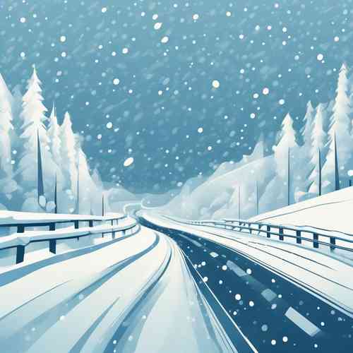
Parts of New York and Pennsylvania have recently been under snow squall warnings. These warnings, issued rapidly for specific areas, are critical for alerting residents to immediate dangers. A snow squall is a brief but intense winter weather event, often linked to strong cold fronts. Unlike a prolonged snowstorm, squalls typically last less than an hour, resulting in minor snow accumulation. However, they are extremely dangerous due to sudden whiteout conditions, rapidly dropping visibility (to less than one-quarter mile), gusty winds exceeding 35 mph, and the immediate threat of icy roads caused by flash freezes. These conditions have historically contributed to deadly traffic accidents.
Safety Measure: Heeding Travel Advisories
Governors, such as Kathy Hochul of New York, have urged people in affected areas to avoid all unnecessary travel due to forecast "whiteout conditions" and strong gusty winds. When snow squall warnings are issued, the advice is clear: avoid or delay travel until the squall passes. There is no truly safe place on the highway during such an event. If already on the road, drivers should reduce speed, turn on headlights and hazard lights, maintain a safe distance from other vehicles, and avoid abrupt braking to prevent loss of control and chain-reaction crashes.
Core Information: Widespread Freeze Warnings
Beyond snow squalls, the dominant concern for many is the widespread subfreezing temperatures. The National Weather Service (NWS) has noted that "subfreezing overnight low temperatures will be found as far south as the Gulf Coast, which has prompted the issuance of Freeze Warnings, Watches, and Cold Weather Advisories across the region." This indicates a broad area where sensitive crops and vegetation could be damaged, and exposed plumbing could freeze and burst if not properly protected. The cold front's passage is expected to bring strong wind gusts and daytime high temperatures 20-25 degrees colder than previous days across the Eastern U.S.
Emergency Preparedness: Vehicle and Personal Safety
Preparing vehicles for winter conditions is paramount. This includes inspecting tires, brakes, and lights, and ensuring all fluids are at appropriate levels. Additionally, a comprehensive emergency kit is essential. Such a kit should contain blankets, non-perishable food, water, a flashlight, a first-aid kit, jumper cables, flares, an ice scraper, a car cell phone charger, a map, and cat litter or sand for tire traction. These provisions can be invaluable during unexpected breakdowns or emergencies in hazardous weather.
Why This Matters (Implications)
The widespread nature of these winter weather phenomena, from intense snow squalls in the Northeast to deep freeze warnings on the Gulf Coast, carries significant implications for various sectors. Public safety is at the forefront, with hazardous driving conditions leading to increased accident risks and the potential for hypothermia or frostbite for those unprepared for the cold. Travel and logistics face major disruptions, impacting supply chains and holiday plans for millions, which can have ripple effects on local economies already navigating post-holiday activity.
Infrastructure is also highly vulnerable. Power outages, like the 57,000 households affected in Michigan, can plunge communities into dangerous cold without heat, further stressing emergency services. The threat of burst pipes due to subfreezing temperatures requires homeowners and businesses to take protective measures, incurring costs and potential damage. For agricultural sectors in the Southern states, freeze warnings are particularly critical, as sudden drops in temperature can devastate crops, impacting livelihoods and food supply chains.
What Experts Are Saying
Weather authorities, particularly the National Weather Service (NWS), are providing crucial, real-time insights into the evolving winter storm. Their advisories form the backbone of public safety recommendations and operational responses.
The NWS has explicitly stated, "A multi-day heavy lake effect snow event is expected downwind of Lakes Erie and Ontario through New Year's Day." This forecast highlights the persistent nature of localized heavy snowfall, demanding continued vigilance in areas susceptible to this phenomenon. Furthermore, their warning that "The Arctic front will continue to bring increasing winds to the Northeast that will remain gusty. Subfreezing overnight low temperatures will be found as far south as the Gulf Coast" underscores the broad geographical impact of the cold, emphasizing the need for cold weather advisories across an unusually wide area.
Officials are not just predicting the weather but also advising on immediate actions. The NWS guidelines on snow squall warnings, for example, offer direct, life-saving information: "Consider avoiding or delaying travel until the snow squall passes your location. If you must travel, use extra caution and allow extra time. Rapid changes in visibility and slick road conditions lead to accidents." These direct warnings from experts emphasize the critical importance of public cooperation and adherence to safety protocols during such volatile weather events.
Potential Impact & Future Outlook
The immediate impact of these winter weather events will continue to be felt through ongoing travel disruptions, heightened risks of accidents on icy roads, and the potential for localized power outages. Communities under freeze warnings, particularly in the Southern U.S., will face challenges protecting infrastructure and sensitive vegetation. The holiday season further complicates these challenges, as emergency services and public infrastructure are stretched dealing with increased travel volume and festive activities.
In the short term, regions affected by lake-effect snow can expect additional accumulations, exacerbating already difficult conditions. The reinforcing Alberta clipper system is projected to bring further snowfall, maintaining the hazard level in specific areas. Looking ahead, the overall trend suggests a continued need for robust winter preparedness strategies. While some areas in the Northern and Central Plains are expected to see a quick warm-up, the persistent nature of cold fronts and the potential for flash freezes means that preparedness for sudden, intense winter phenomena will remain a critical focus for emergency management, infrastructure maintenance, and individual safety protocols in the years to come.
Staying informed and prepared is your best defense against the hazards of winter weather. Heed official warnings, customize your weather alerts, and ensure your home and vehicle are ready for extreme cold. Share this information to help your community stay safe and warm.
Source: https://www.axios.com/2025/12/30/winter-storm-us-midwest-northeast-travel